
Godrej Plots Malur Location
The Godrej Plots Malur location is Malur & Kolar Road, Malur taluk, Kolar district, Karnataka 563130, approximately 2.8 km from Malur town centre.
The single most important planning fact about this address is that Malur is the only taluk in Kolar district that falls within the Bengaluru Metropolitan Region Development Authority’s jurisdiction. That is why the approval authority here is BMRDA rather than an ordinary district authority, and it is a structural distinction from most plotted land elsewhere in Kolar.
Godrej Plots Malur Address

Godrej Plots Malur,
Malur & Kolar Road, Malur Taluk,
Kolar District, Karnataka 563130.
Nearest landmark: Malur Railway Station, 4.1 km.
GPS coordinates: 13.0156° N, 77.9587° E.
| Detail | Value |
|---|---|
| Address | Malur & Kolar Road, Malur |
| Taluk | Malur |
| District | Kolar, Karnataka |
| Pincode | 563130 |
| Coordinates | 13.0156° N, 77.9587° E |
| Planning authority | BMRDA |
| Electricity | BESCOM |
| Distance to Malur town centre | 2.8 km |
Godrej Plots Malur Connectivity

Distances here are road distances and drive times, not straight-line figures; the road routes are indirect, so straight-line distances understate travel from Malur considerably. The numbers below are the ones that matter day to day.
Road and highway access
| Destination | Road Distance | By Car | By Two-Wheeler |
|---|---|---|---|
| KSRTC Depot, Malur | 2.0 km | 4 min | 4 min |
| Malur bus stand | 2.7 km | 9 min | 6 min |
| Malur town centre | 2.8 km | 10 min | 7 min |
| Bengaluru–Chennai Expressway access | 16 km | — | — |
| Hoskote | 20 km | 34 min | 39 min |
| NH-75 nearest interchange | 21 km | 44 min | 45 min |
| Kolar town | 23.7 km | 40 min | 39 min |
| Old Madras Road (SH-35) access | 25 km | 39 min | 47 min |
The Bengaluru–Chennai Expressway at 16 km is the most consequential entry in that table and the one most easily overlooked. It is the infrastructure that changes the east corridor’s travel economics, and proximity to an access point is the kind of locational advantage that holds its value.
Rail
| Station | Road Distance | By Car | By Two-Wheeler |
|---|---|---|---|
| Malur Railway Station | 4.1 km | 16 min | 14 min |
| Whitefield Railway Station | 44 km | 56 min | 1 h 3 min |
| KSR Bengaluru City Junction | 95 km | 2 h 12 min | 2 h 18 min |
Malur Railway Station is on the Bengaluru–Jolarpettai main line towards Chennai. This is existing, operating infrastructure rather than a proposal, which distinguishes it from most connectivity claims made for emerging locations. At 4.1 km it is genuinely usable.
Airport
| Destination | Road Distance | By Car | By Two-Wheeler |
|---|---|---|---|
| Kempegowda International Airport | 70 km | 1 h 8 min | 1 h 21 min |
The airport is 70 km away, about 1 hour 8 minutes by car, which frequent flyers will want to factor into every trip.
Key Distances from Godrej Plots Malur
The key distances from Godrej Plots Malur, by road, are summarised below.
| Destination | Road Distance |
|---|---|
| Malur town centre | 2.8 km |
| Malur Railway Station | 4.1 km (16 min) |
| KIADB Malur Industrial Area | 8.6 km |
| Narsapura Industrial Area | 11.8 km |
| Bengaluru–Chennai Expressway access | 16 km |
| Whitefield | 34.4 km (1 h 16 min) |
| Kempegowda International Airport | 70 km (1 h 8 min) |
| KSR Bengaluru City Junction | 95 km (2 h 12 min) |
Employment Hubs Near Godrej Plots Malur
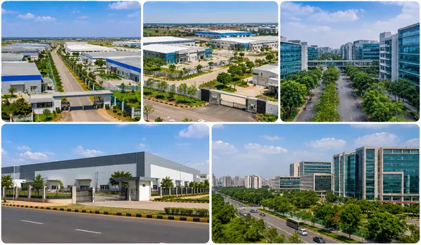
Malur’s employment case rests on industry on its own doorstep rather than on a commute to Bengaluru’s tech corridors. That distinction shapes who this location suits.
| Employment Centre | Road Distance | By Car | By Two-Wheeler |
|---|---|---|---|
| KIADB Malur Industrial Area | 8.6 km | 29 min | 24 min |
| Narsapura Industrial Area | 11.8 km | 18 min | 18 min |
| ITPL | 25 km | 1 h 11 min | 1 h 13 min |
| Hoskote Industrial Area | 25.7 km | 41 min | 48 min |
| Whitefield | 34.4 km | 1 h 16 min | 1 h 9 min |
The two industrial areas are the ones that matter. KIADB Malur at 8.6 km and Narsapura at 11.8 km are short, practical commutes, and they anchor local end-user demand, people who live at Malur because they work at Malur. That is a steadier demand base than investor interest alone, and it is the strongest argument for this location.
Whitefield and ITPL are not commuting distances from here. At 34.4 km and over an hour by car in typical conditions, a daily Bengaluru tech-corridor commute from Malur is not realistic, which buyers should factor in before committing. If your work is in Whitefield, this is a weekend property or a long-term land holding, not a home to commute from.
Schools Near Godrej Plots Malur
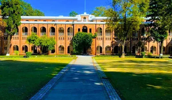
Every school below is within 3.6 km of the site, and the nearest is 500 m away. For a location often described as remote, the education provision within walking and short-driving distance is one of Malur’s genuine strengths.
| School | Road Distance | By Car | By Two-Wheeler |
|---|---|---|---|
| SFS School, Malur | 500 m | 1 min | 1 min |
| Sri Bapuji High School, Malur | 1.5 km | 3 min | 2 min |
| JSS Public School | 1.6 km | 3 min | 3 min |
| Khaki Academy | 3.6 km | 13 min | 11 min |
Distances are approximate. For higher education and specialised streams, families typically look to Kolar or Bengaluru, which is worth factoring into a longer-term plan.
Hospitals Near Godrej Plots Malur

| Facility | Road Distance | By Car | By Two-Wheeler |
|---|---|---|---|
| St. Mary’s Hospital | 1.9 km | 4 min | 4 min |
| Malur Government Hospital | 2.9 km | 9 min | 7 min |
| Sanjeevini Speciality Clinic and Diagnostic Centre | 3.0 km | 9 min | 7 min |
| R. L. Jalappa Narayana Heart Centre, Kolar | 28 km | 44 min | 44 min |
Day-to-day healthcare is well covered within 3 km. For tertiary and specialist care the R. L. Jalappa Narayana Heart Centre at Kolar is 28 km and about 44 minutes away. That is a reasonable position for a taluk town, but it is worth being clear-eyed: for complex specialist treatment, families here travel to Kolar or Bengaluru.
Shopping, Banking and Daily Needs

| Facility | Road Distance | By Car | By Two-Wheeler |
|---|---|---|---|
| Bank of Baroda, Malur branch | 2.5 km | 7 min | 6 min |
| Malur main market | 3.0 km | 7 min | 6 min |
| Union Bank of India | 3.3 km | 11 min | 9 min |
| Akarshana Shopping Centre | 3.3 km | 11 min | 7 min |
| Nexus Whitefield | 35.5 km | 1 h 23 min | 1 h 13 min |
Daily needs, groceries and banking are all comfortably within 3.3 km. Organised mall retail is not: the nearest is Nexus Whitefield at 35.5 km and roughly an hour and a half away. Malur’s retail is functional rather than aspirational, and that is an honest description of taluk-town life rather than a criticism of it.
Malur as a Residential Location
Malur is a taluk town in Kolar district, roughly 45 to 50 km east of Bengaluru city, on the corridor running towards Kolar and on to Chennai. It has an established industrial base, a functioning town centre and a railway station on a main line. It is not a Bengaluru suburb and does not behave like one.
What makes Malur unusual among comparable taluk towns is the combination of three things:
- BMRDA jurisdiction. The only taluk in Kolar district inside the Bengaluru Metropolitan Region, so development here is planned and regulated to metropolitan-region standards.
- An industrial employment base. KIADB Malur and Narsapura together create local jobs, which supports genuine residential demand rather than purely speculative demand.
- Two transport corridors. Main-line rail at 4.1 km and Bengaluru–Chennai Expressway access at 16 km.
From Malligepura to an industrial town
Malur was historically known as Malligepura, after the jasmine (mallige) once widely grown across the taluk, and for generations it was a quiet agrarian centre known for its ragi cultivation. That character has shifted over the past two decades. The KIADB belt around Malur and neighbouring Narsapura has drawn large-scale manufacturing and logistics: the adjacent Narsapura Industrial Area, about 11.8 km away, hosts major manufacturers including Honda, Scania and Mahindra Aerospace, while warehousing and fulfilment operations have grown along the corridor. This industrial base is what anchors local, end-user housing demand rather than purely speculative interest.
The Malur & Kolar Road upgrade
The Malur & Kolar Road that the project fronts is being upgraded as part of a ₹3,190 crore state road programme. The 110 km corridor runs from Devanahalli to the Tamil Nadu border via Vemagal and includes a 25.6 km Hoskote–Malur elevated section, built to move heavy freight past the local villages. For this stretch it means stronger links between the Malur, Narsapura and Vemagal industrial areas and better access towards the Bengaluru–Chennai Expressway and NH-75. As with any large road project the schedule can move, so it is best read as a medium-term upside rather than a delivered benefit.
A complete town, not a greenfield site
Everything daily life requires falls within about 3.5 km of the project, schools from 500 m, hospitals from 1.9 km, two bank branches, the main market and a shopping centre. Buyers considering emerging locations often find that infrastructure follows years after the plots are sold. Here it already exists.
Water Supply
Malur taluk is a notified over-exploited groundwater block. This is a documented constraint across the taluk, not specific to any one project. The public response has been the Yaragol dam scheme drawing on the Markandeya reservoir, which is the water source indicated for this project and a materially stronger basis than borewell dependence. The layout’s connection status and timeline are worth confirming in writing rather than taking as read.
Does This Location Add Long-Term Value?
An assessment of the location’s long-term value, in both directions.
The case for
- Entry price. At ₹4,000 per sq ft, Malur is a fraction of established Bengaluru localities trading between ₹7,000 and ₹14,500. That gap is the investment thesis, and it is real.
- Expressway proximity. Sixteen kilometres to Bengaluru–Chennai Expressway access positions the site on a corridor whose travel economics are still improving.
- Industrial demand. Local employment at 8.6 km and 11.8 km supports end-user demand, which is more durable than investor demand.
- Planning status. BMRDA jurisdiction is a structural advantage over ordinary district land in Kolar.
- Existing amenity base. Schools, hospitals and banking already in place rather than promised.
The case against
- Bengaluru is genuinely far. 34.4 km to Whitefield at over an hour, 70 km to the airport, 95 km to KSR Bengaluru City Junction. A daily city commute is not practical.
- This is a long-horizon holding. Appreciation depends on the industrial corridor and the expressway delivering over years. Buyers wanting a quick resale should look elsewhere.
- Groundwater status. A taluk-wide constraint that the Yaragol scheme addresses but does not erase.
- Limited organised retail and specialist healthcare. Both require travel to Kolar or Bengaluru.
- Pre-launch stage. Verify the project’s registration status before paying any amount.
For a buyer holding land to build eventually, working locally or content not to commute daily, this location has a coherent and honest case. For one needing Bengaluru access several times a week, it does not, and no price advantage will compensate for that.
Godrej Plots Malur Location FAQs
The project is on Malur & Kolar Road in Malur taluk, Kolar district, Karnataka, pincode 563130, at coordinates 13.0156° N, 77.9587° E. It is approximately 2.8 km from Malur town centre.
Whitefield is 34.4 km and about 1 hour 16 minutes by car. KSR Bengaluru City Junction is 95 km and about 2 hours 12 minutes. Kempegowda International Airport is 70 km and about 1 hour 8 minutes. A daily commute into Bengaluru is not practical from Malur.
Yes. Malur is the only taluk in Kolar district that falls within the Bengaluru Metropolitan Region Development Authority’s jurisdiction, which is why the approval authority here is BMRDA rather than an ordinary district authority.
Malur Railway Station is 4.1 km away, about 16 minutes by car. It lies on the Bengaluru–Jolarpettai main line towards Chennai, and is existing operational infrastructure rather than a proposal.
The KIADB Malur Industrial Area is 8.6 km away and Narsapura Industrial Area is 11.8 km. Both are practical daily commutes and anchor local end-user demand. Whitefield and ITPL, at 34.4 km and 25 km respectively, are over an hour away and are not realistic daily commutes.
Yes. SFS School is 500 m away, Sri Bapuji High School 1.5 km and JSS Public School 1.6 km. St. Mary’s Hospital is 1.9 km, Malur Government Hospital 2.9 km and Sanjeevini Speciality Clinic 3.0 km. For specialist care, the R. L. Jalappa Narayana Heart Centre at Kolar is 28 km.
Malur taluk is a notified over-exploited groundwater block, which is a documented constraint across the taluk rather than specific to any project. The project indicates piped water from the Markandeya reservoir via the Yaragol dam scheme, a surface water source that is a materially stronger basis than borewell dependence. The layout’s connection status and timeline are worth confirming in writing before buying.
Plan a Site Visit
Share your details and our team will arrange a site visit, send the location map and answer questions on connectivity and the neighbourhood.